

The town of Uyuni

First view towards Salar de Uyuni
Fuel (Petrol and Diesel) is very cheap in Bolivia as it is subsidized by the government (as in, the opposite to taxing it!). The government however, do not wish to subsidize it for foreign vehicles, so there are 2 prices at every fuel station, the tourist price (9 Bolivians) and the local price (3.27 Bolivians). Remote cameras force the attendants to be sure they give the right fuel to everyone. With a little bit of gentle negotiation, the actual price paid often ends up between 6 and 7 Bolivianos, which is well under a Euro per litre so that’s fine for us. They are not allowed to charge over the tourist price either which is good . The negotiation usually involves explaining that we do not actually need an invoice, and it all takes its own course from that point on. There are however some fuel stations that are not allowed to sell fuel to foreign registered vehicles, and they will direct you on to another station.

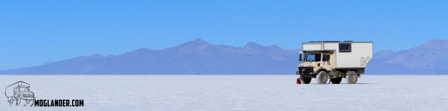
Unimog all set to take on whatever comes in Salar de Uyuini

Great road from Potosi to Uyuni
Salar de Uyuni is Bolivia’s largest salt pan, 12,106-sq-km. It is a center of salt extraction and processing mainly for human consumption, a small percentage is for livestock. There were no roads, if you were lucky you might spot another vehicles track, but most times we made our own.

Amazing salt ridges in the evening sun on the Salar

Sarah manhandling the unimog camper

Sunset on the Salar

Driving at night on the Salar by starlight is amazing!

Star circle on the Salar

Breakfast time while we wait for the Mog to warm up enough to start

Merv’s Mum’s boots came in useful. Thanks Ruthie!

Is that the truck in the distance?

We were nervous of parking the truck on the salt lake all night, so we left it on the table

Merv chilling out

We did spot a few holes in the salt crust.
As we left the Salar and headed South we encountered some bleak but wonderful scenery . Some days the terrain was rough and slow, our slowest was probably 3.5 kms per hour but you were never bored as there was so much to see. We went from being surrounded by volcanoes (one semi-active called Volcan Ollague at 5865 m) to driving across the desert, to great Laguna’s with Flamingoes were we spent the night.

Great colors on the James Flamingo
Laguna Colorado is red in colour and this is derived from the algae and plankton that live in this mineral rich water, Flamingoes also breed here. Whereas Laguna Verde is a stunning blue-green lake due to the high concentration of lead and sulfur, and behind this Laguna you have a great view of Volcan Licancabur standing at 5960m. Here at this lake was really icy cold, our coldest night but we parked on a height (facing east as usual) with stunning views both in the evening and morning. Mind you I didn’t venture out until the sun was well up, after all I didn’t need to take pictures, that’s why I brought a photographer, lol.

Lone Flamingo in the reflection of the mountain

James Flamingo

Flamingos holding their wings open to warm up in the morning sun

Sarah resting while rock climbing

You will always find a place for a hat

Merv’s boots in the cold morning air

Sarah’s boots ready to warm when the morning sun hits the windscreen
We also saw some great unusual rock formations, Stone City I guess you would call it. One in particular was Arbol de Piedra ‘ stone tree’ which really does look like a tree, is made of wind-eroded igneous rock. Apparently climbing competitions used to take part here, but very few people made it to the top, I did try but unsuccessfully.
Another cool spot we stopped at was the 4850m high geyser basins with bubbling mud fumaroles which had a great aroma of sulfer fumes. The sounds were amazing, I guess a good way to describe it was like thick soup boiling like mad. Also close to here were many hot pools of mineral rich water suitable for bathing , and to see the steam rising from them, with the air so cold was just fascinating. The water was warm as we tested it , about 28 degrees incredible really.
As we entered the national park we asked about the Paso San Pedro de Atacama, as we had heard it had been closed due to the snow, we could see that for ourselves now, plus we were hoping it was open as our diesel was getting low, but we had made sure that we still had enough to return a slightly different route back to Uyuni if needed be, (not that we really wanted to) so we were delighted to hear that it was open and could continue on as planned to the Atacama desert in Chile. At 5023 m.a.s.l is a mining operation that extracts borax and it was here that we did the paper work to take our truck out of Bolivia , just for a few days I might add ! . We then had 24 hours to have ourselves stamped out of Bolivia (this rule is not enforced) as we took our time to enjoy every last-minute of this wonderful environment.

Border post between Bolivia and Peru
We did this route during July, which is winter here. Winter is colder, but it is also the dry season. It is possible to make this trip year round, but I would not like to drive my vehicle across the salar when it is flooded with water as you are driving through a few hundred KM of salt water! We would do this drive again in a heartbeat, it was an amazing spin.

Laguna Verde, the green lake was frozen over so we did not see the colors

Early morning sun heating the engine bay from -14 overnight temps

Well dressed scarecrow

One of the better roads on the route between Bolivia and Chile
And a map for those who really want a good look!
[google-map-v3 width=”600″ height=”700″ zoom=”12″ maptype=”hybrid” mapalign=”center” directionhint=”false” language=”default” poweredby=”false” maptypecontrol=”true” pancontrol=”true” zoomcontrol=”true” scalecontrol=”true” streetviewcontrol=”true” scrollwheelcontrol=”false” draggable=”true” tiltfourtyfive=”false” addmarkermashupbubble=”false” addmarkermashupbubble=”false” kml=”http://moglander.com/wp-content/uploads/2013/07/Salar-de-Uyuni-track.gpx” bubbleautopan=”true” showbike=”false” showtraffic=”false” showpanoramio=”false”]
5 Responses to Minus 14 on Salar de Uyuni